Grid reference ST9607
near to Manswood, Dorset, England
Coverage
We have
20 images
in grid square ST9607
Contribute
Explore gridsquare ST9607
Surrounding area
Maps
Loading map... (JavaScript required)
Tip: Click the map to open the coverage map
Sample images
Breakdown list
A sample of 12 photos from 20
for ST9607
- View this square in the Browser >>>

|
Tarrant Monkton, rape fields
by Mike Faherty
|

|
Track round Weekley Coppice
by Toby
|

|
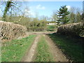
Track junction between Leg Row and Weekley Coppice |

|
Track to Calcotts Coppice, Rushton Hill |

|
Farm buildings by Dean Hill Coppice
by Toby
|

|
Tarrant Rushton, barns
by Mike Faherty
Next to Dean Hill; one open-sided and one covered.
|

|
Bratch Lane |

|
Tarrant Rushton, Dean Hill Coppice
by Mike Faherty
One of several coppices in and around Chetterwood.
|
|
Bratch Lane looking towards Dean Hill |

|
Corner of Weekley Coppice
by Toby
|

|
Holly bushes at edge of Bratch Coppice |

|
Pheasant Shooting Range among coppices
by Toby
See the pegs marking the shooting positions.
|
Explore more images in this square: | View Filtering options | View all 20 images page by page >>> |
|