Your search for images, by Peter Holmes, in reverse Date Submitted order, returns
4,031 images:
( Page 1 2 3 4 5 6 7 8 ... next >> ) [refine search]
[quick refine]
|
Footpath to West Wolves Farm
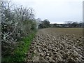
by Peter Holmes geograph for square TQ1217 Tags: [top:Farm, Fishery, Market Gardening] [top:Paths] [top:Sport, Leisure] [type:Geograph] [newly ploughed field] [subject:path] [public footpath] Public Footpath 2492. Ill-defined route along edge of ploughed field.
|

|
Track to Beggars Bush and Lychpole Farm
by Peter Holmes geograph for square TQ1507 Tags: [top:Farm, Fishery, Market Gardening] [top:Roads, Road transport] [top:Sport, Leisure] [top:Village, Rural settlement] [arable land] [farm buildings] [type:Geograph] [Public Bridleway] [subject:track] Public bridleway 2076.
|

|
Farm buildings, Lychpole Farm
by Peter Holmes geograph for square TQ1507 Tags: [top:Farm, Fishery, Market Gardening] [top:Roads, Road transport] [top:Sport, Leisure] [top:Village, Rural settlement] [farm buildings] [type:Geograph] [overhead power lines] [Public Bridleway] [subject:track] [tractor] Tractor on Public bridleway 2078.
|

|
Track at Lychpole farm
by Peter Holmes geograph for square TQ1507 Tags: [top:Farm, Fishery, Market Gardening] [top:Roads, Road transport] [top:Sport, Leisure] [top:Village, Rural settlement] [type:Geograph] [hedges with trees] [overhead power lines] [Public Bridleway] [subject:track] Public bridleway 2078.
|

|
Tractors returning to Lychpole Farm
by Peter Holmes geograph for square TQ1507 Tags: [top:Farm, Fishery, Market Gardening] [top:Roads, Road transport] [top:Sport, Leisure] [top:Village, Rural settlement] [type:Geograph] [Public Bridleway] [subject:track] [tractors] Public bridleway 2078.
|

|
Farm track next to ivy covered trees
by Peter Holmes geograph for square TQ1507 Tags: [top:Farm, Fishery, Market Gardening] [top:Roads, Road transport] [top:Sport, Leisure] [top:Village, Rural settlement] [type:Geograph] [ivy covered trees] [Public Bridleway] [subject:track] Public bridleway 2078 with view of Lychpole Hill.
|

|
Track to Lychpole Farm
by Peter Holmes geograph for square TQ1507 Tags: [top:Farm, Fishery, Market Gardening] [top:Roads, Road transport] [top:Sport, Leisure] [top:Village, Rural settlement] [type:Geograph] [metal gate] [Public Bridleway] [Sheep] [subject:track] Public bridleway 2078 with view of Lychpole Hill.
|

|
Sussex Border Path (5)
by Peter Holmes geograph for square TQ2340 Tags: [top:Farm, Fishery, Market Gardening] [top:Grassland] [top:Paths] [top:Sport, Leisure] [field] [type:Geograph] [subject:path] [public footpath] [trees] Public footpath 321 to Windacre Farm.
|

|
Sussex Border Path (4)
by Peter Holmes geograph for square TQ2341 Tags: [top:Farm, Fishery, Market Gardening] [top:Grassland] [top:Paths] [top:Village, Rural settlement] [type:Geograph] [old barn] [subject:path] [public footpath] [sheep grazing] Public footpath 321 crossing field to Church of St Nicholas.
|

|
Sussex Border Path (3)
by Peter Holmes geograph for square TQ2341 Tags: [top:Farm, Fishery, Market Gardening] [top:Grassland] [top:Paths] [top:Village, Rural settlement] [field] [type:Geograph] [subject:path] [public footpath] [sheep grazing] Public footpath 321 to Windacre Farm.
|

|
Footpath to Rectory Lane
by Peter Holmes geograph for square TQ2341 Tags: [top:Paths] [top:Village, Rural settlement] [top:Woodland, Forest] [type:Geograph] [hedges with trees] [subject:path] [public footpath] Public footpath 326 from Church of St Nicholas.
|

|
Sussex Border Path (2)
by Peter Holmes geograph for square TQ2441 Tags: [top:Historic sites and artefacts] [top:Paths] [top:Sport, Leisure] [type:Geograph] [Grade II listed] [subject:path] [public footpath] [Stone causeway] Public footpath 326 passes in front lychgate, Church of St Nicholas, Charlwood. The Church and the stone causeway running through the Churchyard are both Grade II listed.
|

|
Sussex Border Path (1)
by Peter Holmes geograph for square TQ2441 Tags: [top:Paths] [top:Religious sites] [top:Sport, Leisure] [type:Geograph] [subject:path] [public footpath] [roadside bollards] [war memorial] Public footpath 326 near Charlwood War Memorial.
|

|
Footpath to Ifield Road (2)
by Peter Holmes geograph for square TQ2441 Tags: [top:Paths] [top:Sport, Leisure] [top:Suburb, Urban fringe] [brick wall] [type:Geograph] [subject:path] [public footpath] [uneven footpath] Public footpath 326 from The Street.
|
|
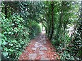
Footpath to Ifield Road (1)
by Peter Holmes geograph for square TQ2440 Tags: [top:Paths] [top:Sport, Leisure] [top:Suburb, Urban fringe] [type:Geograph] [ivy covered trees] [subject:path] [public footpath] [uneven footpath] Public footpath 326 from The Street.
|
Search took 0.00 secs, ( Page 1 2 3 4 5 6 7 8 ... next >> ) [refine search]
· Login to view KML, GPX, or RSS versions of these results.Found these results useful? Please Donate
|