Grid reference SO8360
near to Grimley, Worcestershire, England
Coverage
We have
87 images
in grid square SO8360
Contribute
Explore gridsquare SO8360
Surrounding area
Maps
Loading map... (JavaScript required)
Tip: Click the map to open the coverage map
Sample images
Breakdown list
A sample of 12 photos from 87
for SO8360
- View this square in the Browser >>>

|
Marshy ground near Grimley
by Jeff Gogarty
|

|
Near the end of the main street, Grimley, Worcs
by P L Chadwick
The road soon turns into a rough track leading down to the River Severn. There is a public footpath along this.
SO8360 : The main village street at Grimley, Worcs.
|

|
Lane in the village of Grimley
by Mat Fascione
On the left is St Bartholomew's Churchyard.
|

|
Grazing land for cattle near Grimley
by Bill Boaden
An expansive area to be wandered on west of the village.
|
|
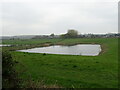
Pond, Grimley
by JThomas
|

|
Window inside St. Bartholomew's church (Grimley)
by Fabian Musto
Two-light window in the south nave wall at Grimley parish church (grade II* listed), which contains good remnants of C15 fragmentary stained glass of an Annunciation.
|

|
The Wagon Wheel
The Wagon Wheel public house in Grimley.
|

|
Boundary Marker near the Wagon Wheel in Grimley parish
Highway Authority boundary post on the north side of the road beyond the Wagon Wheel PH where it becomes a track. Grimley parish. It will probably mark where the councils responsibility for road maintenance ends.
Milestone Society... (more)
|

|
Church Farm Lakes (set of 2 images)
by Mat Fascione
A private fishing lake near the village of Grimley.
|

|
Grimley - St Bartholomew's Church
by Colin Park
|

|
The main village street at Grimley, Worcs
by P L Chadwick
Passing the side of the Wagon Wheel, on the right, the road forks. The left fork is very short giving access to the drive of a private house. According to the Ordnance Survey Map there is a public footpath over this. The right fork... (more)
|

|
St Bartholomew's Church, Grimley
by Chris Allen
You can live within 10 miles of a place yet have never paid it much attention. This applies to many Worcestershire villages and I am slowly beginning to look around them as time permits.
|
Explore more images in this square: | View Filtering options | View all 87 images page by page >>> |
|