Grid reference SO6783
near to Stottesdon, Shropshire, England
Coverage
We have
10 images
in grid square SO6783
Contribute
Explore gridsquare SO6783
Surrounding area
Maps
Loading map... (JavaScript required)
Tip: Click the map to open the coverage map
We have
10 images
for SO6783
|
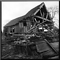
Fallen Barn
by Neil Owen
not only fallen spread everywhere
|

|
Disused Fallen Barn
by Mr M Evison
|
|
Lane passing a rotting barn
by Row17
|
|
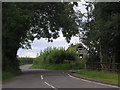
The Highlands - that way
by Richard Webb
Signpost on a junction near Stottesdon.
|
|
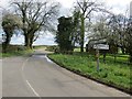
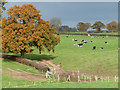
Grazing near Stottesdon, Shropshire
by Roger D Kidd
A public footpath goes off to the left on the other side of the hedge and oak trees.
|
|
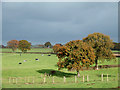
Grazing near Stottesdon, Shropshire
by Roger D Kidd
A public footpath runs along the other side of the hedge and oak trees. Park Wood can be seen on the sky line past the big oak tree.
|
|
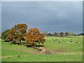
Grazing near Stottesdon, Shropshire
by Roger D Kidd
Looking towards Blundell Farm (just visible on the skyline).
|
|
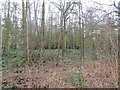
Park Wood
by Richard Webb
Small and rather brambly
|
|
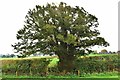
A Field Boundary Yew
by paul wood
This fine Veteran tree sits on a field boundary to the North East of the village of Stottesdon in Shropshire
|
|
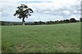
Tree in farmland
Tree in farmland near the village of Stottesdon.
|
|