Shared description
B2038 Road
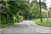
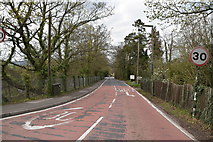
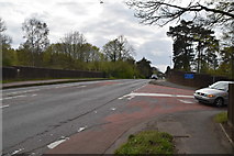
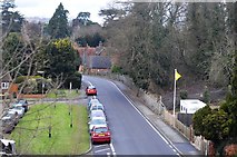
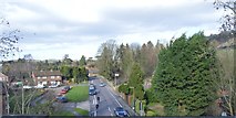
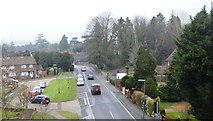
The B2038 is a short link road in Dorking.
It leaves the A24 at a roundabout to the north of Dorking town centre. It goes southeast along Pixham Lane before going under the Guildford to Reigate railway line at a bridge that is narrow and controlled by traffic lights. It ends shortly afterwards at a 'give way' junction on the A25 TQ1750 : Reigate Rd, Pixham Lane junction. A distance of 0.7 miles
It leaves the A24 at a roundabout to the north of Dorking town centre. It goes southeast along Pixham Lane before going under the Guildford to Reigate railway line at a bridge that is narrow and controlled by traffic lights. It ends shortly afterwards at a 'give way' junction on the A25 TQ1750 : Reigate Rd, Pixham Lane junction. A distance of 0.7 miles
by N Chadwick
Created: Thu, 21 Jan 2016, Updated: Tue, 16 Jun 2020
6 images use this description:
2023
2019
2019
2017
2016
2015
Shared descriptions
This shared description
The 'Shared Description' text on this page is © copyright 2016 N Chadwick.
Shared descriptions are specifically licensed so that contributors can reuse them on their own images, without restriction.
About shared descriptions
These Shared Descriptions are common to multiple images.
For example, you can create a generic description for an object shown in a photo, and reuse the description on all photos of the object. All descriptions are public and shared between contributors, i.e. you can reuse a description created by others, just as they can use yours.
Explore images
Log in to view extended navigation and 'Explore' links.Other shared descriptions
Descriptions nearby
- Dorking Cemetery
- Dorking Deepdene Station
- Pixham End Roundabout cycling statue
- Dorking Station
- Listed Buildings and Structures
- The Deepdene and Chart Park
- Signalboxes
- ESSO
- River Mole
- Sutton & Mole Valley Lines
- A24 Road
- A25 Road
- CAMRA Good Beer Guide entry Pubs
- North Downs Line
Related descriptions
- Pixham End Roundabout cycling statue
By Ian Capper. Used on 9 images
- Dorking Cemetery
By N Chadwick. Used on 18 images
- Guildford Station
By N Chadwick. Used on 131 images
- Reigate Station
By N Chadwick. Used on 14 images
- Adlers Lane
By Hugh Craddock. Used on 5 images
- Bridleway 26 Guildford
By Hugh Craddock. Used on 4 images
- Milton Court Lane
By Hugh Craddock. Used on 3 images
The above selections are automatic and approximate, it might not always select closely matching descriptions