Grid reference SE7444
near to Melbourne, East Riding of Yorkshire, England
Coverage
We have
55 images
in grid square SE7444
Contribute
Explore gridsquare SE7444
Surrounding area
Maps
Loading map... (JavaScript required)
Tip: Click the map to open the coverage map
Sample images
Breakdown list
images taken from SE7444 [1]
A sample of 12 photos from 55
for SE7444
- View this square in the Browser >>>

|
Kissing gate at Town's Ings north of Melbourne
by Ian S
|

|
Kidd Lane junction
by Glyn Drury
|
|
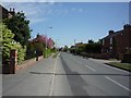
Melbourne main road
Looking westwards.
|
|
The Barn in Melbourne
by DS Pugh
Looking along the village of Melbourne, East Yorkshire.
|

|
Pocklington Canal, swingbridge
Swing bridge number 6 on the Pocklington Canal, which is navigable at this point.
|

|
The Black Drain
Probably named after the peaty nature of the land it flows through.
|

|
The Shetlands near Melbourne
by JThomas
|

|
The Beck
Taken from the bridge crossing The Beck, with The Ings and Westfield Farm in the distance.
|

|
Path across Town's Ings near Melbourne, E Yorks
by Colin Park
|
|
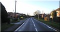
Melbourne
by David Dixon
The B1228 approaching Melbourne.
|

|
Pocklington Canal
by David Brown
|

|
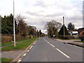
The road out of Melbourne
by Paul Harrop
Looking away from the village along the main road towards Sutton upon Derwent
|
Explore more images in this square: | View Filtering options | View all 55 images page by page >>> |
|