Grid reference SD9950
near to Skipton, North Yorkshire, England
Coverage
We have
79 images
in grid square SD9950
Contribute
Explore gridsquare SD9950
Surrounding area
Maps
Loading map... (JavaScript required)
Tip: Click the map to open the coverage map
Sample images
Breakdown list
images taken from SD9950 [1]
A sample of 12 photos from 79
for SD9950
- View this square in the Browser >>>

|
Mile marker on west side of Leeds and Liverpool Canal at 28 miles from Leeds
The post is opposite High Laithe Farm and has Milestone Society National ID: LLC-099¼
|

|
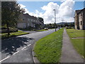
Greatwood and Horseclose Community Centre
On North Parade
|
|
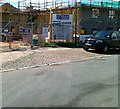
4 new houses, Rombalds Drive, Horse Close |
|
Cawder Road - viewed from Sharphaw Avenue (set of 2 images) |

|
Canal Two Path towards Skipton
by Les Hull
|
|
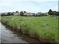
Sheep grazing on the skirts of Skipton
Very appropriate, as Skipton means Sheep Town. Another Yorkshire example of 'sh' changing to 'sk' is Shire Oak becoming Skyrack. The distant houses are in Sharphaw Avenue.
|
|
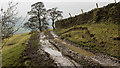
Muddy farm route near to Cawder Hall Farm
Cawder Hall Farm lies on a slope south-east from Skipton. The road is on the north side of Cawder Gill.
|

|
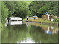
Leeds and Liverpool Canal |

|
Canalside Fields, Low Snaygill
Heading south on the canal back into farmland after a few kms of urban cruising through Skipton.
|

|
November, midday, on the Leeds and Liverpool Canal |
|
Skipton - Leeds and Liverpool Canal
by Colin Smith
The canal reach by Snaygill is popular with boaters and walkers with a marina and restaurant nearby.
Link
|

|
Approaching Bridge No. 180 on the Leeds and Liverpool Canal
by Gordon Brown
|
Explore more images in this square: | View Filtering options | View all 79 images page by page >>> |
|